Time to set off: 9:30 a.m.
Destination: Bride's Pool, Tai Po
Theme: Upper Course of a River Valley
Weather: Cloudy with little sunshine
¡@

Field Trip to Bride's Pool #1
| Date: 4th November
2000
Time to set off: 9:30 a.m. Destination: Bride's Pool, Tai Po Theme: Upper Course of a River Valley Weather: Cloudy with little sunshine ¡@ |
 |
¡@
 |
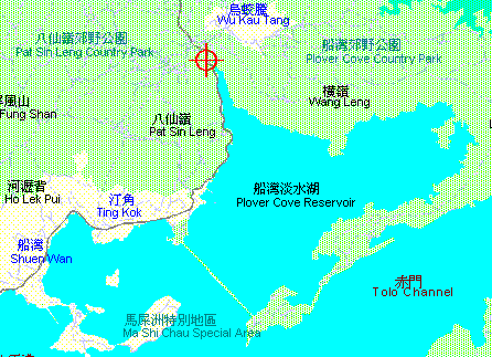
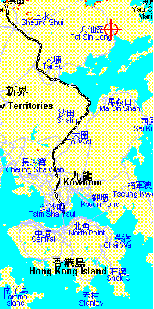
Bride's Pool is located in the remote
rural area of Tai Po, which is 22 km from North Point. Actually, the
site belongs to Northern District of the New Territories. This is
chosen as the destination for the second Geography Field Trip because this
part of the area has great value for academic studies. Let me give
you some background information about the area.
Let's talk about the geology. The area is covered with sedimentary rocks. You can find different kinds of sedimentary rocks around Bride's Pool, such as conglomerate, sandstone, and slate, which is changed from shale after metamorphism. The types of rock greatly affect the geomorphology (i.e. about the relief) of the area. Conglomerate is more resistant and forms the high mountain range, Pat Sin Leng. At the foothill of Pat Sin Leng, you can see a river running towards the Plover Cove Reservoir. This part of the river belongs to the upper course. It contains a lot of fluvial features which are of good value for studies. They include waterfall, plunge pool and potholes. The lower course of this river has already been covered with water after the construction of the reservoir. ¡@ |
After getting off at the Tai Mei Tuk Bus Terminus, we started to walk uphill to Bride's Pool. This trip was really educational as we could enjoy the nature and learn about our countryside. We visited the Visitor's Centre at the foothill of Pat Sin Leng. There, we could find some general information about the geology, relief and vegetation around the area. Along the way, we could see a buffalo, which was probably abandoned by those farmers in the past. A toad could also be seen...
¡@